
Waterfalls at Mount Rainier: Best Hikes & Stops for Your Trip


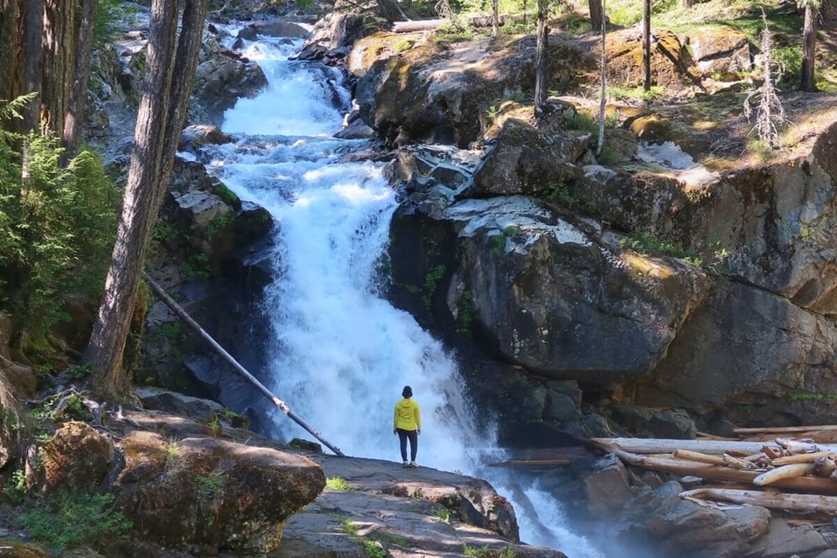
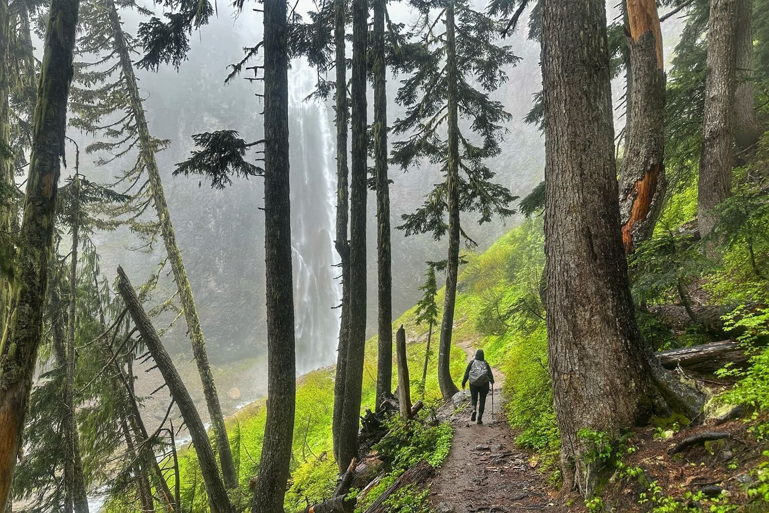
When the view of Silver Falls opened up before me, its massive scale and the jagged volcanic slabs surrounding it took my breath away.
But what made it a great stop on our early July trip wasn’t just the view, it was how perfectly it fit into our day.
After a late start on a peak-season weekend, instead of sitting in the afternoon car line at the Nisqually Entrance, we headed to Silver Falls and were hiking within minutes.
Afterward, we continued toward Paradise through the Stevens Canyon Entrance, where we breezed into the park without a line.
If you’re wondering which Mount Rainier waterfall to choose for your first trip, it’s not just about picking the prettiest one. It depends on your route, how much time you have, and what else you want to see that day.
Some waterfalls are quick roadside stops, while others require hikes that can take one to three hours.
Timing matters, too.
Waterfalls are especially powerful from late spring into early summer as winter snow melts across Rainier’s glaciers and feeds the park’s waterfalls, rivers, and creeks.
I visit Mount Rainier year-round and help first-time visitors understand how the park’s hikes, attractions, and changing seasons shape a well-paced itinerary.
I’ll share the best waterfalls at Mount Rainier, which ones are worth prioritizing for your trip, and insider tips I’ve learned from visiting them in different seasons — including where to look for waterfalls you won’t find on the usual lists.
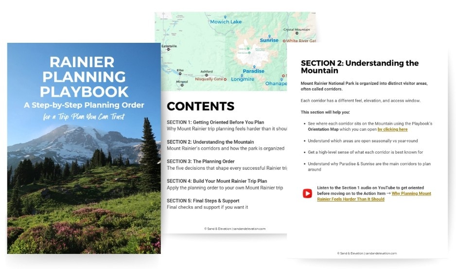
You'll learn how Rainier's visitor areas, entrances, and base towns fit together — so you can build a trip plan that works.
Rainier has five visitor areas:
Longmire, Paradise, Ohanapecosh, Sunrise, and Carbon River (closed). Longmire and Paradise are open year-round, while Paradise and Sunrise are the most popular.
Mount Rainier Waterfalls: Things to Know Before You Go
I like to compare a visit to Mount Rainier to Thanksgiving dinner. Seeing the Mountain is the turkey. It’s good on its own, but most of us would agree the sides are what really make the meal.
The waterfalls, forest trails, and river walks are those sides. They’re an essential part of the Rainier experience — and excellent destinations when the Mountain isn’t out.
Where to See Waterfalls in Mount Rainier National Park
If waterfalls are a priority, I’d spend more time in Paradise, Longmire, and Ohanepecosh than Sunrise.
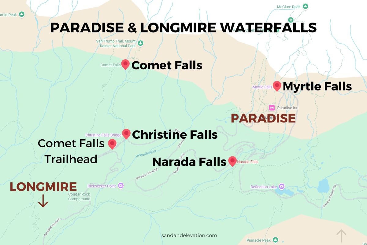
The Paradise and Longmire corridors are open year-round and offer easy-to-access waterfall stops along the road between the two visitor areas.
Even though parking is limited at Christine Falls, most visitors stop for only 10–15 minutes. My family had no problem getting a spot on a Saturday afternoon in mid-July.
Seasonal considerations: Ohanepecosh is accessible when the park’s seasonal roads are open, generally from late May through early fall. Sunrise is typically accessible from early to mid-July through September or early October.
Best Time to See Waterfalls at Mount Rainier
Late spring through early summer brings powerful waterfall flows as snow melts across Mount Rainier. But peak waterfall flow doesn’t necessarily mean peak waterfall access.
Lingering snow can keep trails and roads closed.
On a late May trip, the spur trail down to Myrtle Falls was still blocked off, as it is throughout winter. I overheard a volunteer ranger directing disappointed visitors to Narada Falls instead.
When Stevens Canyon Road and State Route 123 close seasonally, Ohanapecosh waterfalls, including Silver Falls, become inaccessible.
Some of my best waterfall experiences have been in late June and early July, when flows are still strong from snowmelt but trails are becoming increasingly snow-free.
Waterfalls accessible year-round: Christine Falls & Narada Falls along the road between Longmire and Paradise
Mount Rainier Waterfalls That Are Easiest to Access
You don’t have to be a hardcore hiker to enjoy some of Mount Rainier’s waterfalls.
My 70-year-old parents enjoyed the upper viewpoint at Narada Falls from the edge of the parking area.
Christine Falls is a quick roadside stop, while Myrtle Falls and Edith Creek are relatively easy additions to a day at Paradise.
Just don’t assume “short” always means completely effortless at Rainier. Some viewpoints and trails have steep sections, even when you’re only walking a short distance.
Easy-to-access waterfalls: Christine Falls between Longmire and Paradise; Myrtle Falls & Edith Creek at Paradise
Waterfalls To Prioritize on a 1-Day or 2-Day Trip
If you only have one day at Mount Rainier, I’d prioritize the Paradise meadows, including the hike to Myrtle Falls.
Narada Falls works well as a stop along Paradise Valley Road, giving you two memorable waterfalls without sacrificing a large portion of your only day in the park.
With two or more full days, you have more flexibility.
When all areas are accessible, I tell trip-planning clients visiting Sunrise to prioritize getting a parking spot to hike higher elevation trails.
Then add Silver Falls in Ohanapecosh when your route takes you through the southeast side of the park.
Best for a 1-day trip: Myrtle Falls & Narada Falls in Paradise
How Weather Affects Waterfall Viewing at Mount Rainier
If the weather is clear and the Mountain is out, you’ll likely want to prioritize higher elevation mountain views. But don’t automatically write off a cloudy or rainy Rainier day.
When clouds hide the Mountain, lower-elevation waterfall trails in Longmire and Ohanapecosh are a fantastic backup plan.
We hiked to Comet Falls in Longmire on a rainy late-June day, and the low-hanging mist around the falls was incredible.
Instead of losing a day to bad weather, we put on our rain gear and Comet Falls became one of the highlights of our trip.
That’s why I recommend having at least one lower-elevation waterfall option in your itinerary. Rainier’s weather can change quickly, and having a backup plan means you’ll have somewhere worthwhile to go.
Best waterfall hikes if it’s cloudy or rainy: Comet Falls in Longmire; Silver Falls in Ohanepecosh

Stop Guessing Your Way Around Mount Rainier
Seeing Rainier’s waterfalls sounds simple until you realize they’re spread across different areas of the park.
Which ones make sense depends on when you’re visiting, how much time you have, and what else you want to see.
➥ My Rainier Planning Playbook shows you how visitor areas, entrances, roads, and base towns fit together so you can build an itinerary you know will work.
Waterfall Hikes in Paradise With Mount Rainier in the Background
There’s only one visitor area at Mount Rainier where you’ll see waterfalls and a view of the Mountain at the same time: Paradise.
The good news is that the first waterfall on this list is also one of the easiest hikes at Paradise, the Skyline Trail to Myrtle Falls.
If you’re doing a day trip to Mount Rainier, add this hike to your itinerary.
1. Myrtle Falls & Edith Creek
- Miles: 1 mile
- Elevation: 164 feet
- Difficulty: Easy to Moderate
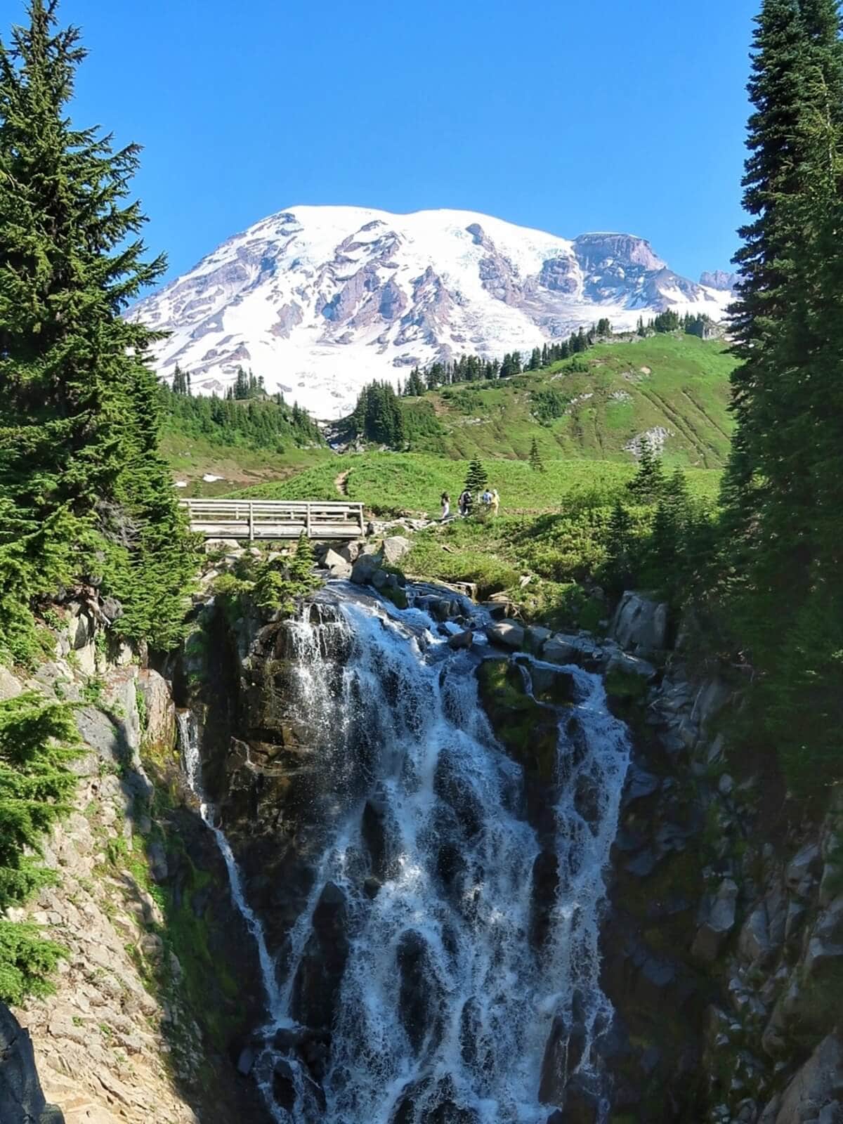
Skyline Trail to Myrtle Falls is my go-to waterfall hike for first-time visitors because you get two of Mount Rainier’s most iconic photo spots in one short walk.
What to know
- Paved with a short, unpaved spur to the Myrtle Falls viewpoint.
- Visit in early summer through fall to access the Myrtle Falls spur trail.
- There are some moderately steep sections, but I always see kids and multi-generational families on this trail, making it a great option for most visitors.
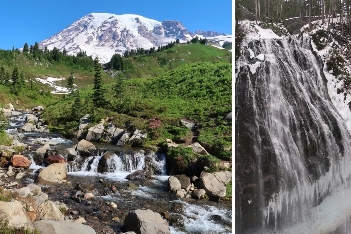
- You’ll get two views: Edith Creek with Mount Rainier behind it and Myrtle Falls with the footbridge and Mount Rainier in the background.
Travel tip
If you’re visiting on a busy day, make this your first stop at Paradise for the fewest crowds. If you don’t plan to hike the full Skyline Loop, don’t automatically turn around at Myrtle Falls. Continue past Edith Creek.
The meadows beyond are some of my favorite places to photograph Rainier’s wildflowers in summer and fall color in autumn.
2. Sluiskin Falls
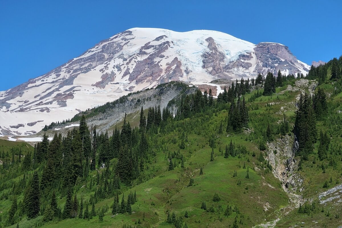
Sluiskin Falls isn’t the kind of waterfall you hike right up to, but it’s a beautiful bonus if you’re already exploring the Skyline Trail.
If you don’t know it’s there, spotting it along the rock face in the distance becomes one of those gleeful, “Hey, there’s a waterfall!” moments.
I get a kick out of spotting it from different viewpoints as I continue climbing past Edith Creek, especially with Rainier in the background.
What to know
- There isn’t a trail that takes you to the base of the falls.
- Visible from multiple viewpoints along the Skyline Trail beyond Edith Creek if you’re hiking counter-clockwise.
- The lower viewpoints showcase the waterfall best. Higher on the trail, you’ll trade closer waterfall views for sweeping views of Mount Rainier.
Travel tip
Sluiskin Falls isn’t a destination waterfall. Instead, enjoy it as one of the many scenic highlights along the Skyline Trail.
Roadside Waterfall Stops at Mt Rainier Open Year-Round
Driving between Paradise and Longmire, you’ll pass two of Mount Rainier’s best attractions: roadside waterfall stops that are accessible year-round.
3. Narada Falls
- Miles: .2 mile
- Elevation: 59 feet
- Difficulty: Easy
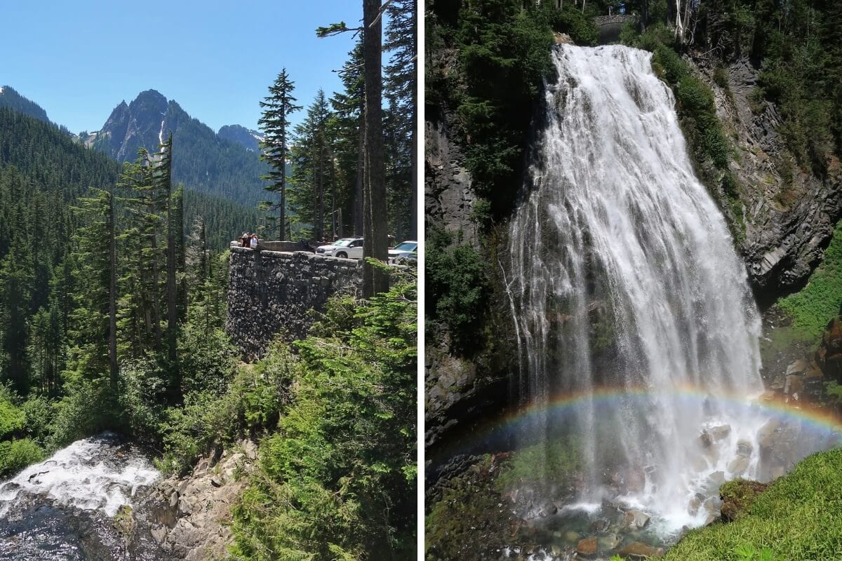
Narada Falls delivers a huge payoff for such a short hike.
I’ve visited every season, and seeing it surrounded by icicles in winter is just as incredible as seeing a rainbow at its base on a sunny summer afternoon.
What to know
- The upper viewpoint is at the edge of the parking area, but the best views require a short, steep, and rocky hike. Use trekking poles if you’re heading to the lowest viewing platform.
- Rainbows are most common on sunny afternoons when sunlight reaches the falls.
- Although there are only a handful of marked parking spaces, visitors also park in rows in the middle of the large asphalt lot.
- Open year-round, although snow and ice can affect the trail to the lower viewpoints.
Travel tip
If you’re visiting Paradise during peak summer and it’s still morning, don’t stop here first. Secure a parking spot at Paradise before the lot fills, then visit Narada Falls on your drive out.
Bonus waterfalls
Along the Narada Falls Loop Trail, you’ll also pass Washington Cascades and catch views of Ruby Falls. Most visitors never notice Ruby Falls because there isn’t a safe place to pull over along Stevens Canyon Road.
4. Christine Falls
- Time needed: 10–15 minutes
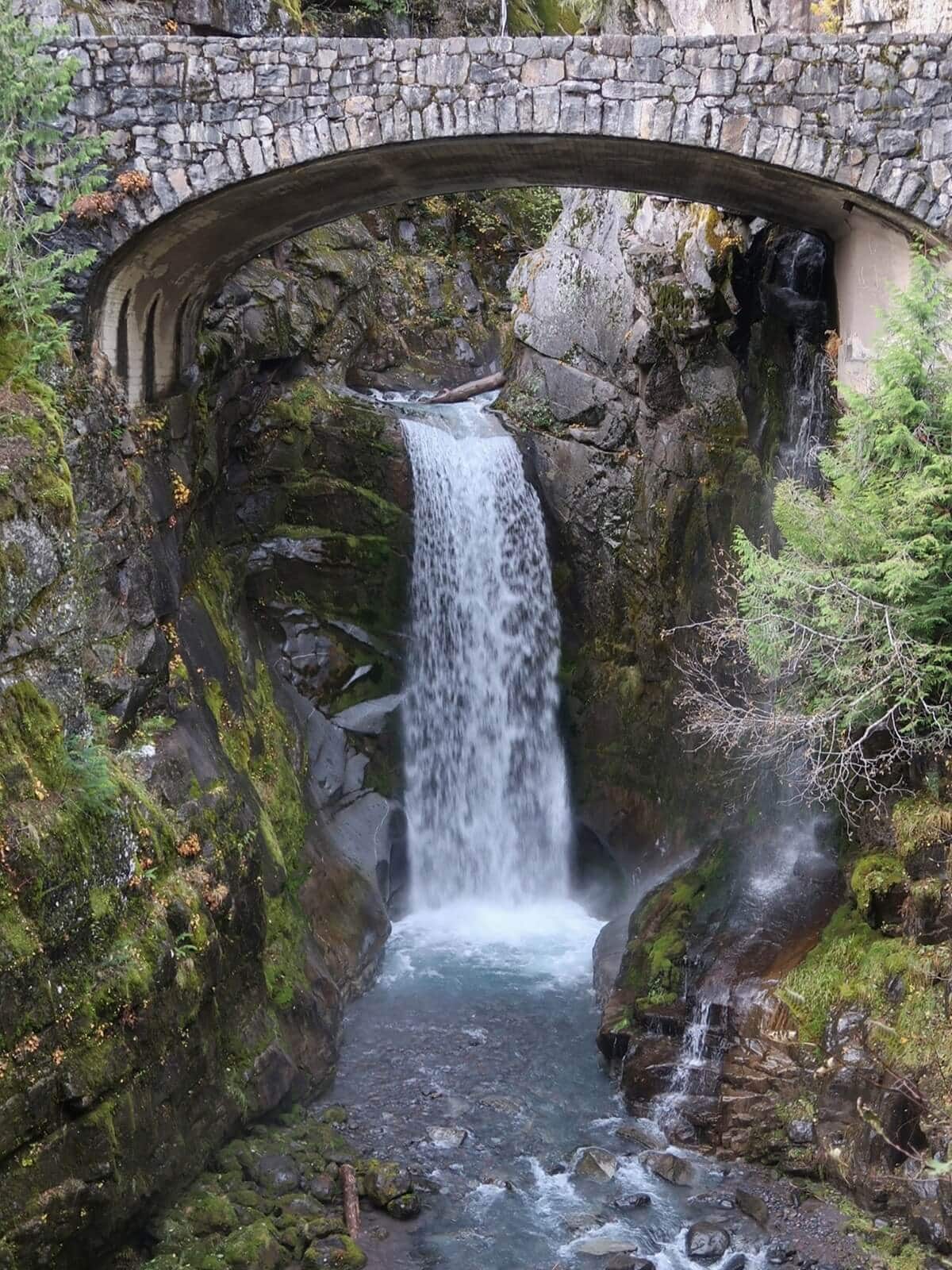
Christine Falls is a perfect example of how a man-made structure can enhance a natural attraction.
I’ve stopped here in every season, and I’m always impressed by the craftsmanship of the stone bridge framing the falls, constructed in the 1930s.
What to know
- A short trail leads to the best viewpoint, where you’ll see the waterfall below the bridge.
- From the road and parking area, you’ll see Van Trump Creek flowing through a glacier-carved gorge before plunging beneath the historic stone bridge.
- While parking is limited, most visitors stay only 10–15 minutes, so spaces tend to open up quickly.
- Open year-round, though trail conditions can be snowy or icy in winter.
Travel tip
There isn’t much shoulder along Paradise Valley Road, so be cautious of traffic if you’re walking between the parking area and viewpoint.
As you drive out of the park, sit by the right-side window to watch Van Trump Creek tumble toward Christine Falls.
Why You Should Add Longmire Waterfalls to Your Itinerary
Christine Falls mentioned above is technically a Longmire area attraction.
But there are two waterfalls in Longmire that require more hiking to get to, and earn a spot on your Mount Rainier itinerary for different reasons.
5. Comet Falls
- Miles: 3.6 miles
- Elevation: 1,290 feet
- Difficulty: Moderate to Hard
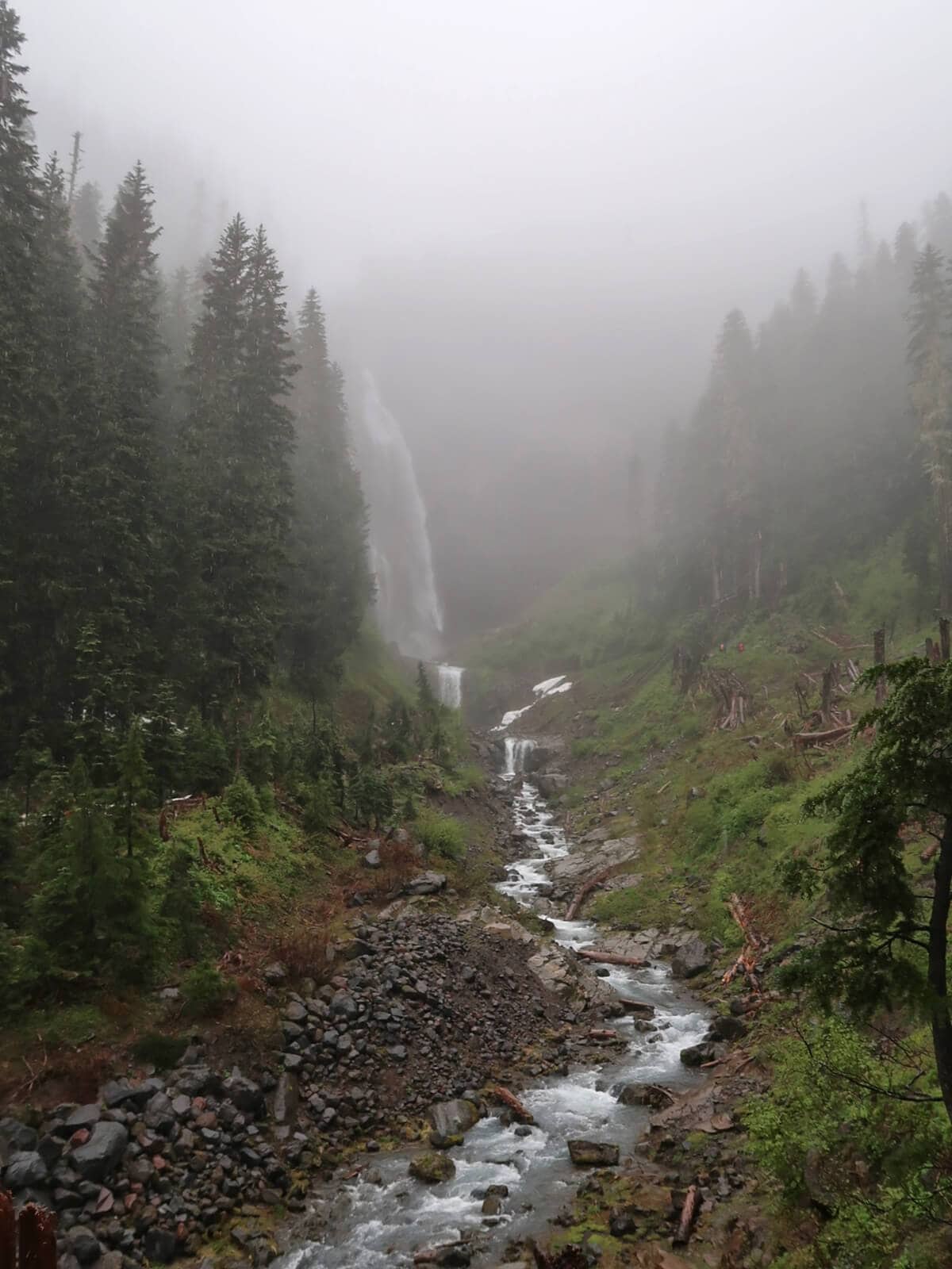
Comet Falls is arguably the park’s best waterfall hike.
Spotting the 320-foot waterfall as we hiked toward it along the creek floor was incredible. Standing near its base and feeling the mist coming off the thunderous falls was almost “too much nature” according to Jenna, my hiking partner.
If you’ve already seen the Paradise meadows and have extra time in the park, do not hesitate to do this hike.
What to know
- Gains elevation quickly with rocky, root-filled sections, so sturdy footwear and trekking poles are helpful.
- You’ll cross Van Trump Creek on a footbridge and see Van Trump Falls before climbing to the base of Comet Falls.
- Continue hiking past the falls to Van Trump Park for sweeping views of Mount Adams and Mount St. Helens.
- Check trip reports before doing this hike early in the season, when snow can make the trail more hazardous.
Travel tip
If rain is in the forecast during your trip, this hike is a smart pivot. The mist and lush forest make Comet Falls even more dramatic on cloudy days.
6. Carter Falls & Madcap Falls
- Miles: 2.5 miles
- Elevation: 520 feet
- Difficulty: Easy to Moderate
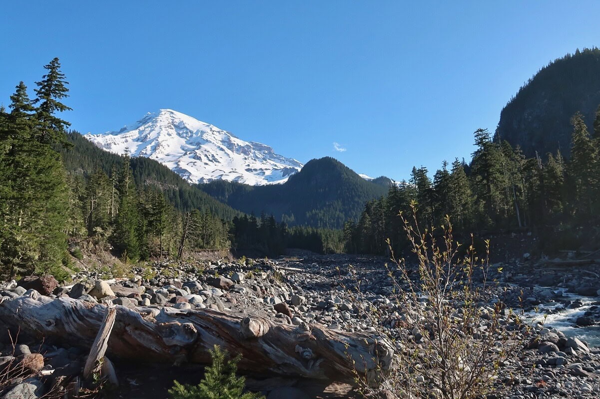
I haven’t had the chance to hike to Carter Falls yet because the bridge was washed out for much of the past winter and early spring. It’s high on my list for my next visit to Longmire.
The start of the hike also gives you an excellent view of the Mountain from the Nisqually River basin, one of my favorite mountain views in Longmire.
What to know
- Convenient hike to do if you’re camping at the Cougar Rock Campground
- Continue upstream to see Madcap Falls
Travel tip
This hike makes a great backup plan if you’re visiting Mount Rainier in winter and the road to Paradise is closed. Since hiking options become much more limited, you can follow the Wonderland Trail from Longmire to Carter Falls.
When Ohanapecosh Waterfalls Makes Sense & When They Don’t
You won’t get the classic waterfall-with-Rainier-behind-it views you get at Paradise, but Ohanapecosh offers a much more immersive forest-and-river experience.
Ohanapecosh waterfalls make the most sense when surrounding park roads are open and you’re already exploring the east or southeast side of the park.
Because Stevens Canyon Road and sections of SR 123 close seasonally, these aren’t waterfalls I’d build a late-fall, winter, or early-spring itinerary around.
Even in summer, I wouldn’t send a first-time visitor across the park just to check Silver Falls off a list.
Pair these waterfalls with Sunrise, Stevens Canyon Road, or a stay near Packwood so they fit naturally into your route.
7. Silver Falls
- Miles: .7 mile or 2.9 miles
- Elevation: 140 feet or 520 feet
- Difficulty: Easy
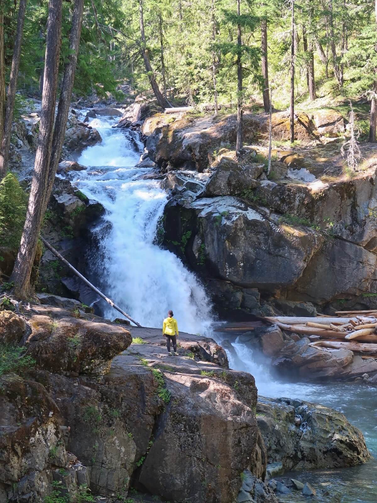
Of all the Rainier waterfalls I’ve seen, this one offered the most immersive experience.
The first viewpoint gave us a jaw-dropping head-on view of Silver Falls, but the experience only got better as we continued down the trail.
We took the spur trail to a massive rock ledge surrounded by moss- and fern-covered cliffs, where the Ohanapecosh River roared in front of us.
What to know
- You can hike a short out-and-back trail from the Laughingwater Creek Trailhead or a longer loop that starts near the Ohanapecosh Campground.
- You’ll hike through old-growth forest to several viewpoints of the falls, including the view from a wooden bridge spanning a gorge where water flows beneath you.
- Open when Stevens Canyon Road and SR 123 provide access to Ohanapecosh.
Travel tip
Visit Silver Falls after exploring Sunrise or before or after driving Stevens Canyon Road. It makes a perfect stop on your way back toward Packwood and gives you a completely different experience from the park’s higher-elevation trails.
8. Stafford Falls
- Miles: 3.5 miles
- Elevation: 561 feet
- Difficulty: Easy
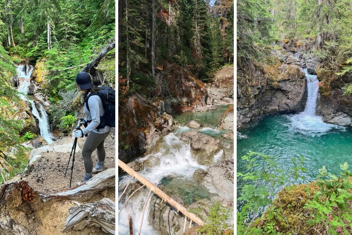
The Eastside Trail to Stafford Falls gives you more waterfall payoff than the trail name suggests.
On our hike, we saw three waterfalls along the route, and Stafford Falls wasn’t even my favorite.
What to know
- You’ll pass Deer Creek Falls and Chinook Cascades before reaching Stafford Falls.
- Chinook Cascades was the surprise of this hike for me. I actually enjoyed it more than Stafford Falls, especially the clear pools, exposed volcanic rock, and multiple tiers of rushing water.
- Pullout parking is available off SR 123. The sign at the trailhead actually says Owyhigh Lakes Trail.
- AllTrails didn’t show the left turn to Stafford Falls, but we spotted a visible path and took it.
Travel tip
If it’s hot out and you’re ready to escape the crowds at Sunrise, hike this trail. We passed only two groups on our hike.
Does Sunrise at Mount Rainier Have Waterfalls?
You may be wondering why you keep seeing waterfalls associated with Paradise, Longmire, and Ohanapecosh, but almost nothing associated with Sunrise.
The National Park Service doesn’t include Sunrise among its main waterfall areas, and I wouldn’t choose this side of the park if waterfalls are your priority.
That doesn’t mean you won’t see any.
9. Unnamed Waterfalls on the Summerland Trail
- Miles: 11.5 miles
- Elevation: 3,050 feet
- Difficulty: Hard
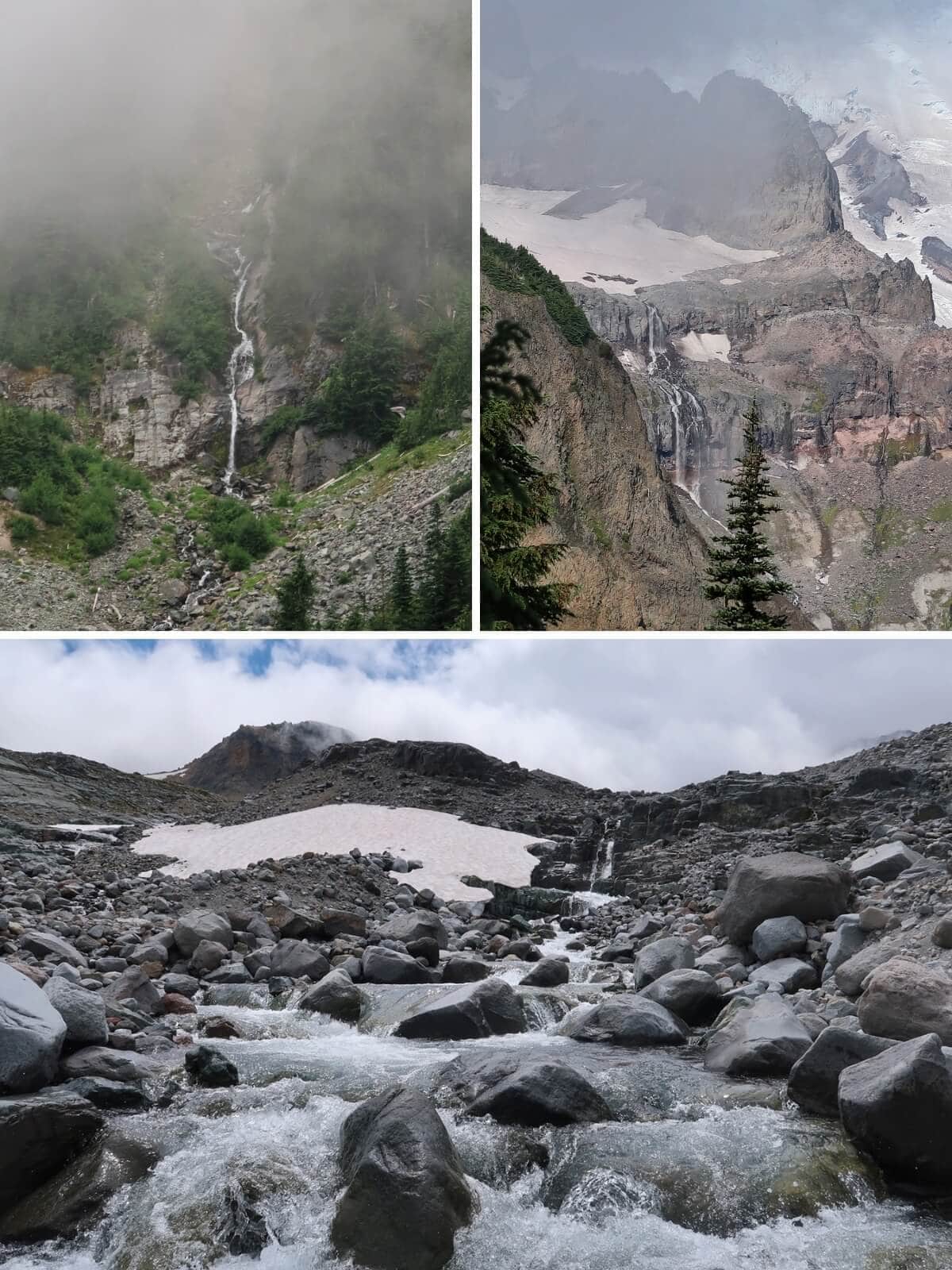
On the Summerland Trail, I spotted an unnamed waterfall cascading down the mountainside as we hiked through the forest, while sections of Fryingpan Creek cascaded over boulders beside the trail.
Beyond Summerland Camp, as you continue toward Panhandle Gap, you’ll see another waterfall dropping over rocky terrain in the distance long before you reach it.
But it was the highest unnamed waterfall that captivated me most. It was fascinating to wonder if I was looking at the highest water source that fed the creek I had just hiked alongside for miles.
What to know
- The waterfalls here aren’t named attractions with designated viewpoints. You’ll spot them naturally as you hike.
Travel tip
Get to the Summerland Trailhead early if you’re hiking during peak summer. We arrived at 5:40am on a Saturday and there were only a few parking spots left.
Travel Tips for Visiting Mount Rainier’s Waterfalls
Waterfalls are some of the most rewarding attractions to work into a Mount Rainier itinerary.
These are a few things I’ve learned from visiting the park in different seasons.
Save Waterfall Hikes for a Plan B on Cloudy or Rainy Days
Rainy or cloudy weather happens, but it doesn’t mean you can’t have a great time, especially if you work waterfalls, creeks, and river views into your day.
One winter day when the Mountain was covered in clouds, Colby and I took the short walk to the Nisqually River basin near the Carter Falls trailhead. Then we drove to Christine Falls and Narada Falls.
He gave this day, clouds, rain, and all, a 9/10 rating.
Know What Footwear You’ll Need on Waterfall Trails
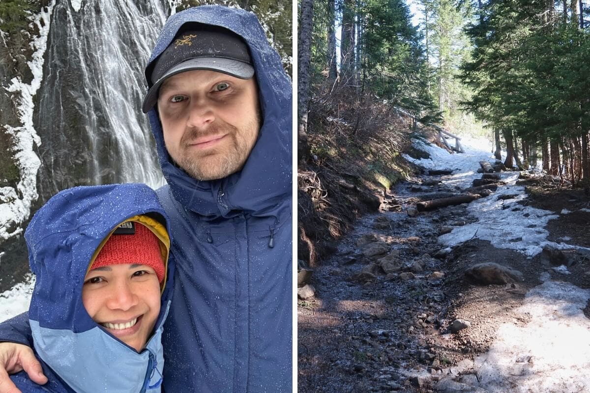
I watched a group choose to slide down the snow on their butts on the spur trail to Myrtle Falls in November because they didn’t wear microspikes or bring poles.
In April, I talked with a couple who had traveled from the East Coast but couldn’t make it all the way down to the best viewing area at Narada Falls because they weren’t prepared for the lingering snow and ice.
Don’t assume a short waterfall hike means an easy walk in every season. Check current trail conditions before you go, and bring microspikes and trekking poles when snow or ice is present.
Keep an Eye Out for Unnamed Waterfalls
The first time I stood on Glacier Bridge, my sister spotted two unnamed waterfalls in the distance. From that moment forward, I knew to look toward the snowline, especially above glacier-carved valleys.
When snow is melting in late spring and early summer, occasionally look beyond the trail and scan the surrounding slopes. Some of Rainier’s best waterfall sightings are the ones you didn’t expect.
I’ve since spotted unnamed waterfalls along the Sunrise Rim Trail, the Summerland Trail, and in other parts of the park that don’t show up on a map.
Which Waterfalls Are Best for Your Trip to Mount Rainier?
So which waterfalls belong on your itinerary?
That depends on when you’re visiting, which areas of the park you’re already planning to explore, how much time you have, and how much hiking you want to do.
The goal isn’t to see every waterfall. It’s to choose the ones that naturally fit the rest of your trip.
- Myrtle Falls: Prioritize it on a first visit when the trail is accessible and you’re visiting Paradise.
- Narada Falls & Christine Falls: Reliable year-round options.
- Silver Falls: Add it when the roads are open and Ohanapecosh fits naturally into your route.
But choosing waterfalls is only one piece of planning a Mount Rainier trip.
You still have to decide which areas to visit, how to divide your days, where to stay, and how everything fits together without spending half your trip driving back and forth across the park.
That’s exactly what my Rainier Planning Playbook is designed to help with.
I walk you through the same planning framework I use with my one-on-one clients, from understanding Rainier’s different visitor areas and entrances to choosing a home base and building an itinerary that makes sense for your trip.
➥ Get the Rainier Planning Playbook
RELATED TRIP PLANNING POSTS:
➥ How to Visit Mount Rainier & Plan the Perfect Trip Length
➥ Best Time to Visit Mount Rainier: Will the Mountain Be Out?
➥ 17 BEST Things to Do at Mount Rainier (Non-Hikers Too!)
➥ 7 BEST Towns Near Mount Rainier for First-Time Visitors
➥ 15 BEST Places to Stay Near Mount Rainier (& Places to Skip!)
➥ National Park Inn Review: Pros, Cons & Why I’d Return
➥ A First-Timer’s Guide to Paradise at Mt Rainier (Hikes & Attractions)
➥ Longmire Mount Rainier: What to Do, When to Visit & Why It’s Worth It
➥ Mount Rainier 1-Day Itinerary (Best Hikes & Stops)
➥ Skyline Loop Trail Guide: 10 Reasons It’s WA’s Best Day Hike
➥ 10 Tips to Avoid Crowds at Mount Rainier in Peak Season
